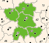
Discover the Allier on a bike |
From one riverbank to another,
Distance: 147 km - 8 hours
Red level - difficult
Altitude difference: 832 m
Markup: green and white
This circuit of 147 kilometers for 832 meters of elevation is the longest of the department. After crossing the Allier river in Moulins, you will walk to Saint-Pourçain-sur-Sioule between forests, hedgerows and vineyards. You pass on the other bank of the Allier to Billy and start a beautiful hilly section through the Forterre and its landscapes mixing field crops and meadows. The return is made by Sologne Bourbonnaise on a more peaceful profile. A beautiful and long day of cycling in perspective!
Read more |
Through the vineyard
Distance: 44 km - 2:45
Red level - difficult
Altitude difference: 375 m
Markup: green and white
Departing from Saint-Pourçain-sur-Sioule, this 44-kilometer circuit with 375 meters of vertical drop is rather hilly with some nice climbs. You will discover the vineyards of Saint-Pourcinois through picturesque villages like Verneuil-en-Bourbonnais. The typical landscapes of the bocage bourbonnais and Val d'Allier will also embellish this beautiful ride!
Read more |
Between valleys and groves
Distance: 111 km - 7:30
Black level - very difficult
Altitude difference: 1131 m
Markup: green and white
From Chantelle, this very sporty long-distance course (111 kilometers and 1131 vertical meters) is one of the most spectacular in the department! A beautiful climb awaits you through the forest of Colettes before crossing the wild valleys carved by the rivers Bouble and Belon. After Montmarault, you enter a wooded area with a less rugged profile. The vines come to decorate the landscape around Saint-Pourçain-sur-Sioule before returning to Chantelle by beautiful small winding roads and hilly.
Read more |
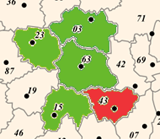
A trip to the country of Montluçon
Distance: 88 km - 5h15
Red level - difficult
Altitude difference: 532 m
Markup: green and white
It is in Montluçon on the banks of the Cher that you take the start of this hilly hike of 88 kilometers for 532 meters of elevation gain. You first take a green path on the banks of the Berry Canal before leaving for a long and beautiful stroll in the grove, country breeding, hedgerows and green hills. You join the charming spa town of Neris-les-Bains. Then another greenway with beautiful views takes you back to Montlucon.
Read more |
From the Val de Besbre to the Loire Valley
Distance: 112 km - 5h30
Red level - difficult
Altitude difference: 565 m
Markup: green and white
This beautiful circuit of 112 kilometers for 565 meters of elevation starts at Dompierre and goes up the river Besbre to Lapalisse castle castle. A very hilly section then leads to the Dungeon through green hills. Then very quickly you will approach the Loire River with its canals. On the way back, you will take the greenway built along the canal side to the Loire for a quiet ride between locks and canal-bridge. What happiness!
Read more |
Country walk around Beaulon
Distance: 22 km - 1h45
Green level - very easy
Altitude difference: 70 m
Markup: green and white
This peaceful, 22-kilometer, 70-meter vertical walk begins in the charming village of Beaulon. On a very gently hilly road, you will discover the typical landscapes of Sologne bourbonnaise, characterized by its numerous ponds. In Dompierre-sur-Besbre, you will follow the greenway built from the nautical stopping place to the side canal to the Loire. You will then pass the Abbey of Sept-Fons and join Beaulon.
Read more |
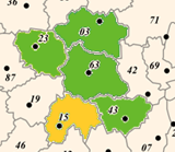
In the heart of the Bourbonnaise Mountain
Distance: 62 km - 5h30
Black level - very difficult
Altitude difference: 1015 m
Markup: green and white
With more than 1,000 meters of vertical drop and the crossing of two passes, this 62-kilometer circuit is the most sporty in the Allier department! From Mayet-de-Montagne, you will reach Châtel-Montagne with its Romanesque church then Arfeuilles before starting a long and beautiful climb to the Verrerie plateau at more than 1,000 meters altitude. You will ride in a particularly wild and unspoiled environment with spectacular views. A long, deserved descent will then take you back to Mayet de Montagne.
Read more |
On the way to Limagne
Distance: 71 km - 4 hours
Red level - difficult
Altitude difference: 477 m
Markup: green and white
Departing from Saint-Pourçain-sur-Sioule, this 71-kilometer, 477-meter vertical course explores different types of landscapes, atmospheres and reliefs. After a very hilly first part through the vineyards of Saint-Pourcin, you pass the rivers Bouble and Sioule and pedal on the more peaceful roads of Limagne bourbonnaise. Very rolling, the return is by the Val d'Allier.
Read more |
The foothills of the Montagne Bourbonnaise
Distance: 96 km - 7h
Black level - very difficult
Altitude difference: 855 m
Markup: green and white
Departing from Vichy, the queen of water towns, this 96-kilometer sports course with 855 meters of elevation takes you to the foothills of the Montagne Bourbonnaise. After a beautiful ascent to Mayet-de-Montagne, from valleys to valleys, you discover charming villages like Châtel-Montagne or Arfeuilles. After the mountain, the route will take you to Lapalisse then Billy with their castles. The return to Vichy takes place along the river Allier. An exit full of discoveries!
Read more |
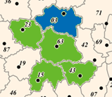
Escape between Sioule and Bouble
Distance: 66 km - 4h45
Black level - very difficult
Altitude difference: 789 m
Markup: green and white
This very sporty course of 66 kilometers for 789 meters of elevation gain is undoubtedly one of the most emblematic of the department. From Charroux, one of the "Most Beautiful Villages of France", you will follow the river Sioule to the steep gorges of Chouvigny. A very strong ascent will begin then towards La Bosse at 720 meters altitude. You will then cross the green forest of Colettes then the city of Chantelle with its abbey before returning to Charroux.
Read more |
The ponds of Sologne Bourbonnaise
Distance: 69 km - 3.30 hours
Red level - difficult
Altitude difference: 222 m
Markup: green and white
Departing from Moulins, city of art and history, this very rolling 69-kilometer circuit for only 222 meters of elevation takes you through Sologne Bourbonnaise. You will discover a landscape made of meadows, forests and small ponds for a beautiful bucolic walk.
Read more |
Medieval town in a grove
Distance: 68 km - 4h30
Red level - difficult
Altitude difference: 564 m
Markup: green and white
This 68-kilometer sports course with 564 meters of vertical drop is one of the most emblematic of the department in terms of heritage and landscape. It begins in Bourbon-l'Archambault, spa town and cradle of the last dynasty of the kings of France. You will also discover Agonges, the commune with 13 castles as well as Souvigny and its prieurale church. Between these stages, beautiful small country roads wind through the bocage bourbonnais!
Read more |
The fortress of Val d'Aumance
Distance: 37 km - 2h15
Blue level - easy
Altitude difference: 254 m
Markup: green and white
It is in the hollow of a loop of the river Aumance, Hérisson, that begins this charming little course of 37 kilometers for 254 meters of elevation. You first join Louroux-Hodement on a rather ascendant profile. The effort is rewarded by a long descent to the Berry Canal and a beautiful ride on the greenway built along it. After Vallon-en-Sully, you arrive very quickly in the valley of the Aumance that you go back. We can distinguish Hedgehog, nestled at the feet of his fortress.
Read more |
Stroll in the forest of Tronçais
Distance: 40 km - 2.5 hours
Blue level - easy
Altitude difference: 289 m
Markup: green and white
Covering nearly 11,000 hectares, the Tronçais forest is considered one of the most beautiful oak forests in Europe. Leaving from Cérilly, you will start a 40-kilometer course with 289 meters of vertical drop. You will cross the forest in which Colbert planted the oaks intended to build the ships of the French fleet. You will also pass by the small medieval city of Ainay-le-Château and will skirt several ponds. A real moment of escape!
Read more |
In the land of "truths"
Distance: 87 km - 4h45
Red level - difficult
Altitude difference: 711 m
Markup: green and white
This very hilly circuit of 87 kilometers with 711 meters of altitude begins at Lapalisse, cradle of lapalissades and one of the greatest knights of the 15th and 16th centuries. A very sporty portion will take you through the green hills of the Donjon. You will then follow the canal Roanne Digoin in a peaceful atmosphere before joining Lapalisse by beautiful winding roads and steep. The most of the course: superb panoramas!
Read more |
From the Val du Besbre to the Loire Valley by the Puy St-Ambroise
Distance: 80 km - 4 hours
Red level - difficult
Altitude difference: 520 m
Markup: green and white
This variant of 80 kilometers for 520 meters of elevation will take you from the river Besbre to the Loire River in a particularly rural atmosphere. Between the two rivers, you will make a nice ascent to the Puy Saint-Ambroise, former volcano culminating at 436 meters above sea level. On the way back, you will pedal peacefully along the canal side to the Loire on a beautiful portion in greenway, between locks and canal-bridges.
Read more |
| |

 Creuse